Red Lights Are Costing Us Billions, But Connected Car Data Offers a Solution
Poorly timed traffic lights waste time and money, but are difficult to fix. A University of Michigan study uses connected cars for a simpler remedy.

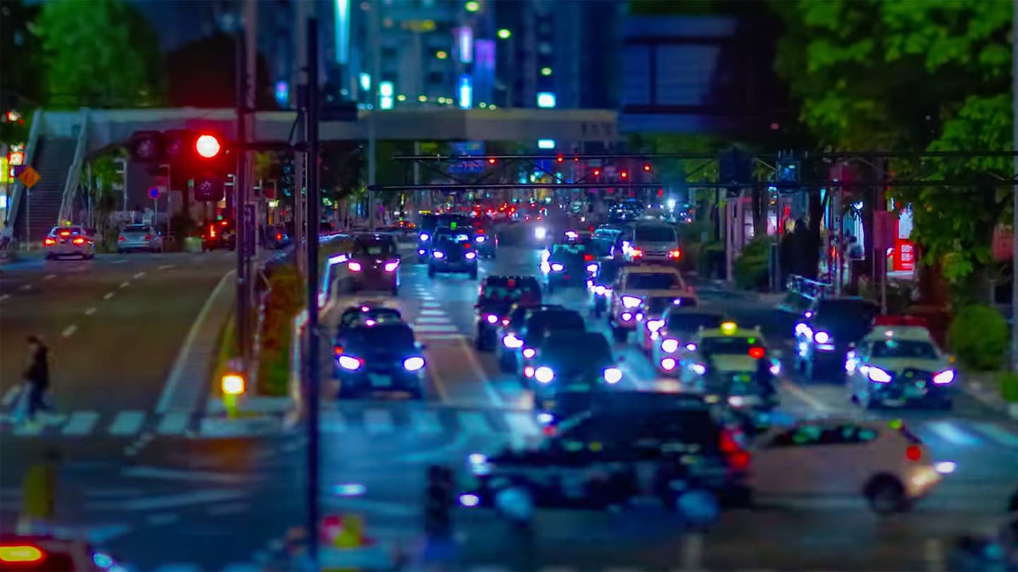
According to the 2019 Traffic Signal Benchmarking and State of the Practice Report, sitting at red lights and the associated traffic caused by them costs society almost $23 billion a year. Even worse, vehicles driving in typical high-congestion conditions can emit up to four times the carbon monoxide, carbon dioxide, nitrogen oxides, and particulates. The extra wear and tear on your vehicle and wasted time are the least horrible of the negative effects caused by traffic. Engineers at the University of Michigan have developed a new method for creating traffic models using data from connected cars that will allow traffic light timing to be optimized every few months, rather than every few years—and at a much lower cost.
Most traffic control systems in the US are poorly optimized, relying on preprogrammed timing-based on outdated traffic studies. Gathering data for a single intersection can cost over $5,000. That doesn’t seem so bad, until you consider there are more than 330,000 traffic light-controlled intersections in the United States. On top of that, traditional traffic studies give snapshots of intersections, rather than a complete picture of citywide flow.
One option is adaptive traffic lights using vehicle detection technology. These have been around for 50 years, but can cost anywhere from $15,000 to $100,000 to implement. The least-expensive form of this tech are in-road sensors installed in one lane in each direction during new construction; the opposite end of the spectrum requires retrofitting giant multi-lane intersections with cameras along with pre-detection devices positioned upstream. No matter how you build your combo plate to fix even two-thirds of US traffic lights, you’re getting a number followed by nine zeros. I should mention: they all require regular maintenance.
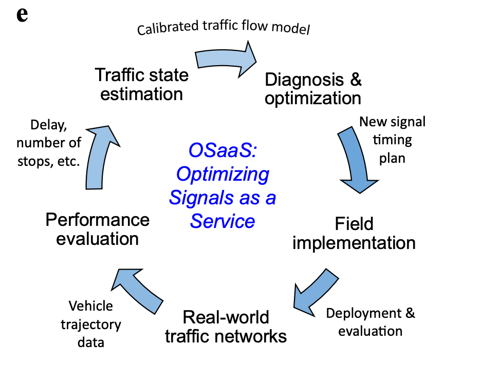
In the attached video, Professor Henry Liu, Director of The Center for Connected and Automated Transportation explains how traffic flow information can be gathered using existing data car manufacturers already possess. Testing for the study was executed in Birmingham, Michigan using information supplied by a small number of GM connected cars. Once models were built and analyzed, new timing plans were implemented that decreased travel times by 20%, and the need to stop at traffic lights by 30%.
The video does a good job of summarizing the need for the new system and the results. If you’re interested in the how after seeing the why, continue below. I will keep the mathiness-level as low as possible.

Talk Nerdy to Me
Typical traffic studies focus on the number of vehicles traveling through a specific intersection. This can be done the old-fashioned way using people, usually underappreciated civil engineering interns, sitting at an intersection manually counting cars. It can be automated using a data logger connected to a rubber hose stretched across traffic lanes, inductive sensors placed in the road during construction, or even video cameras. The method employed in the University of Michigan study used connected car data—basically GPS speed, direction, and location information that systems like OnStar are constantly monitoring.
How the data is gathered plays a big part in how you can model it. Traffic flow can be modeled the same way as fluids, like aero analysis of cars. If you’re optimizing a given geographic area of traffic, but only have data on individual intersections, you model that data using what’s called Eulerian coordinates. This takes a large single area, like the area around a car or for traffic in an entire city, and breaks it into smaller volumes. For a car you might look at where the hood meets the windshield; for traffic, a single intersection. Particle volume and movement are analyzed in that one small area. Since you are only looking at the flow through select locations and not what’s occurring between them, you don’t have a full picture of what’s happening.
Conversely, you could use Lagrangian coordinates. This method tracks individual particles along a complete journey through the entire area using a single reference point-based coordinate system. For traffic, this requires the ability to track individual cars along their entire routes. It gives you locations based on time, but changes in speed and direction have to be calculated. Studies with Lagrangian coordinates have been done using cellphone data, which is neither continuous nor accurate. You end up with huge amounts of data as you are forced to follow a large number of cars to try and get accurate data over the entire city.
The engineers from UM used a method utilizing Newellian coordinates, which track vehicle trajectories over the entire area being studied, but can easily pull out data from specific areas. This also provides speed, routing, delays, and stops. While most traditional forms of traffic monitoring only show the volume of cars traveling through an intersection with an estimated speed, this new method allows researchers to see speeds and delays between intersections. Not only does this give a more concise model of what is currently happening, but the data is more easily manipulated in simulations to test different timing strategies.
I am just scratching the surface of how this was done without getting into the math involved in the calculations, but hopefully, I have put this in terms that are at least vaguely digestible without having to pull out the old textbooks. It’s been many years since I was an engineering student. I’m not ashamed to admit that a good deal of the traffic flow-specific math was beyond me. But, if you’ve made it this far, I would encourage you to at least skim through the paper.
Birmingham, Michigan isn’t a metropolis. It only has 34 traffic lights, but the new system is scalable to cities of any size. In some cases, there is just too much traffic to ever achieve a free-flowing state. That’s when options like better bike infrastructure, more public transportation options, and other efforts have to be made to reduce traffic. And let’s be honest: every city should be looking at those options anyway, no matter their size. But, in locations where traffic is being constrained by poorly timed lights, there’s now a cost-effective way to save drivers time and money, all while drastically reducing pollution.
Got tips? Send 'em to tips@thedrive.com